Find further information on the Conservation of Freshwater Ecosystem Values (CFEV) Program and its data at www.dpipwe.tas.gov.au/cfev.
TitleCFEV Wetlands
CustodianWater and Marine Resources Division, Department of Primary Industries, Parks, Water and Environment
CreatorGIS Unit, Information and Land Services Division, Department of Primary Industries and Water (DPIW)
DescriptionWetlands of Tasmania
Input data
Lineage
Rules for amalgamating TASVEG and LIST wetland polygons
The following rules were used to amalgamate the TASVEG and LIST wetland polygons. An illustration for each rule is given in Figure 1.
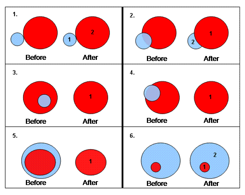
Figure 1. Diagrams to accompany rules for amalgamating TASVEG and LIST wetland polygons. Red = TASVEG wetland and Blue = LIST wetland.
Data limitations
Wetlands <0.5 ha that could not be assigned with an appropriate wetland vegetation type were deleted from the data set.
Date createdOctober 2004
Scale and coverage1:25 000; Statewide
References
DPIW. (2003). TASVEG 0.1 May 2003. Tasmanian Monitoring and Mapping Program. Department of Primary Industries and Water, Hobart.
Harris, S. and Kitchener, A. (2003). Tasmania's vegetation: a technical manual for TASVEG, Tasmania's vegetation map: Version 1.0. (Draft). Department of Primary Industries, Water and Environment, Hobart.